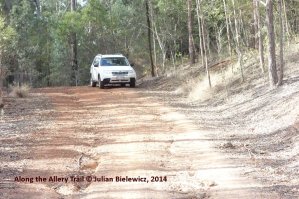
It wasn’t even our primary objective. The Allery Trail was no more than a means to a broader end; finding another access point to the segmented Brisbane Valley Rail Trail.
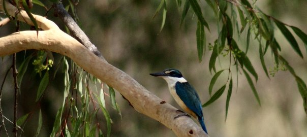
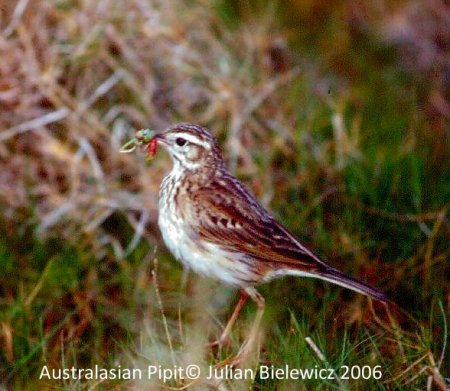
We’d first come across the Brisbane Valley Rail Trail back in May 2010. It was Colleen Fingland, along with her husband, Robert, who had first introduced us to the walk. We covered a few kilometres from the Blackbutt end, out towards Benarkin, before the heat of the day decided us to admit that discretion was, after all, the better part of valour – or at least the safer side of skin cancer. Nevertheless we came away with a list of 36 species with gems such as Red-rumped Parrot and Rose Robin among the day’s tally.
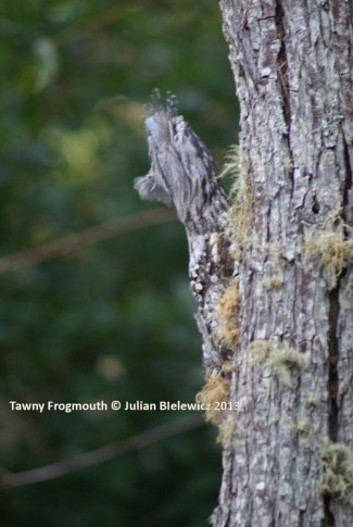
Our next sortie on the Rail Trail was not until April 2011 when we discovered an unscheduled, or at least an unmapped access point off the D’Aguilar Highway. However, as it was only a matter of metres from the Benarkin Railway Station official access it served little purpose in solving the overall difficulty. On that occasion we again left matters a little late in the day; t was already past peak daylight hours by the time we found the side track down to the old railway. We came away with a disappointing tally of only nine species although that did include very close views of a Tawny Frogmouth perched near eye-level up a small sapling.
It took more than a year [October 2012] before we ventured out onto the Rail Trail again.
By now we were beginning to appreciate the segmented nature of the Rail Trail. Stretching some 45km, it has only a limited number of access points between Yarraman and Linville. It is rumoured that the Rail Trail will eventually reach out all the way to Ipswich but for Fay and I anything further than Linville lies beyond the Wide World and is of no interest to timid moles or cautious water rats.
In October 2012 we made our way to Ditchmen Park, the Linville end of the Rail Trail, hoping to make our way back towards Benarkin. It has to be appreciated that back in that period of the sojourn we were unaware of the total length of the Trail; unaware of its segments or of each segmental distance. In fact, when poised at Ditchmen Park we had never actually looked at a map of each segment or one of the entire route. We were babes in pioneering arms; avian adventures up the creek without a reliable paddle.
Perhaps not too surprising then that throughout 2013 we failed to record any surveys along the Brisbane Valley Rail Trail.
Matters took on a different complexion in early March 2014, during the first Saturday of the month in fact; Nanango’s monthly Market Day. Fay was chasing replacement ducks for our aging quartet of Welsh Harlequins and the three surviving Indian Runners were all drakes. I was still hopeful of finding a brace of pheasant. What we found was a stall maintained by volunteers of the Brisbane Valley Rail Trail who willingly supplied us with two brochures, “on the right track: Nukku Road to Yarraman” and “on the right track: Moore to Blackbutt.” Both provided rough mudmaps of the Rail Trail, although the latter was the larger and more useful of the maps.
The pennies were beginning to fall into place. The Rail Trail was segmented, sectionalized, with specific access points to each sector. And for the first time we had official distances.
The younger, fitter, elements of society could walk the entire length [and back] although bicycles and horses are allowed. Those of a more delicate nature could tackle the Rail Trail segment by segment [there and back again] on different days. Those more disposed to idling had a choice:
-
Walk part way and return, tackling the same section from the other end at a different time
-
Take two vehicles; leave one at the eventual “end.” Drive around to the “beginning” of the selected segment, walk to the designated “end” and then simply drive back to the “beginning” where the second walker would pick up their awaiting car.
That worked reasonably well until one came to the last segment, Benarkin to Linville – 18km each way! At our age that was clearly a bridge too far.
And therein lay the challenge. We needed further access points somewhere between Benarkin and Linville to bring the 18km down to more manageable distances.
It was Fay who first discovered the existence of the Allery Trail. If we were reading the green-dotted track [the Allery Trail] aright it intersected with the Brisbane Valley Rail Trail at some point along the D’Aguilar Highway. Further perusal of the mudmap clearly showed that for at least part of its 31km circuitous route, the Allery Trail simply followed the Old Esk Road and that was a part of the world we knew.
The plan became glaringly obvious: drive down to the Old Esk Road, link up with the Allery Trail and follow that until we arrived at its intersection with the Brisbane Valley Rail Trail. Piece of cake!
Well, not quite. We had programmed EMILY [our Garmin GPS unit] to lead the way. She did well up to midway along Taromeo Road when she wanted us to take a left into William Road. There was no William Road to take a left into. We retraced our steps and again EMILY advised us to [this time] take a right onto William Road but there was still no William Road to be seen from behind the windscreen.
We executed another U-turn and a few kilometres along found ourselves at a major Y-junction but according to EMILY this was beyond our desired turning point. We returned to the site of the mythical William Road and did notice a narrow forestry track on our right. However, apart from a discarded television monitor and a handful of Red-browed Finches there seemed to be no passage through to the Allery Trail.
Back to the aforementioned Y-junction. Again, it was Fay who first spotted the rather discreet sign pointing to the right-hand fork; designated by a rather unpretentiously sign, with minute printing above a short, narrow, black arrow, “Rail Trail”.
We diligently followed this, looking and listening out for bird life until we reached a second Y-junction. The fork to the left read “Sandy Creek”; a smaller, somewhat modest, sign on the right simply read “Rail Trail.” There was no mention of the “Allery Trail” but further consultation with our small-scale mudmaps suggested that we were in fact on part of the Allery Trail. It dropped sharply downhill and disappeared around a sharpish left-hand bend some 50m away.
Always firm followers in that old adage about discretion being the better side of valour, we parked the Forester at this point and walked down to the bend to scout out the lie of the topography.
The gravel road continued downhill for another one hundred or so metres before taking a right-hand bend. We continued downhill. On reaching the bend, the road slid down another few hundred metres before turning again. We went on, looking and listening out for birds. The road disappeared around yet another bend, always heading downhill, always seemingly becoming steeper.
The birding itself was meagre; the ubiquitous Grey Fantail was the first species to actually show itself, as distinct from the half dozen “heard only” birds to that point. Nevertheless, at the next bend we agreed to persevere… just to the next downhill bend. And then the next. We had no pedometer at that time [it came a little later] but guessed we had travelled several kilometres/miles, always downhill.
|
Section
|
Distance
|
|
Yarraman to Harland Park
|
7.5km
|
|
Harland Park to Nukku Road
|
6.5km
|
|
Nukku Road to Blackbutt
|
4km
|
|
Blackbutt to Benarkin
|
8.5km
|
|
Benarkin to Linville
|
18km
|
The Lewin’s Honeyeater and Bell Miner became our next “seen” birds. We carried on and then heard the distinctive roar of an overworked heavy engine. It didn’t need rocket science to realise that not too far ahead [below] us was the D’Aguilar Highway. We were surely nearing the crucial part of the Allery Trail.
By the time we reached the next bend we suddenly became aware of the horrible truth; we knew exactly where we were heading for and that we had been here before.
The January 2011 floods created havoc in the Blackbutt Ranges with major landslides blocking off access to Blackbutt and beyond from that direction [east]. Indeed, severe flooding in the Gympie area [to the north] and massive water damage in and around Toowoomba [to the south] virtually isolated the immediate area; Fay and I were marooned on our own property for three days.
As part of the rebuilding program, the D’Aguilar Highway running through the Blackbutt Ranges was eventually opened piecemeal with contraflow traffic allowed through in 15-minute blocks, either up from Moore or down to Moore and beyond. By coincidence, the traffic lights on the Blackbutt side of the one-way system were position just after the old railway bridge; below was the track bed, now part of the Brisbane Valley Rail Trail.
At the time we were barely aware of its existence, having walked along its Blackbutt section only the once, in May 2010. However, on a number of the many occasions when we mis-timed our approach to the lights and were forced to wait for the changeover, we did notice a forest track leading back off and uphill from the highway. There was an open area at the foot of the forest track.
Later, in April 2011, when we had become aware of the Rail Trail, we pulled up in the lay-bye created by the earth-moving machinery and attempted to find a way down to the track bed. Tangled vines and thorny bushes had the better of the encounter, forcing us to abandon any hopes of an access point hereabouts.
Now, as we approached the last 500m of the Allery Trail, we knew that on the last bend we would be standing in that same lay-bye off the D’Aguilar Highway. We had walked down the same forestry track we had first noticed going up from the side of the D’Aguilar Highway but had failed to investigate in our attempts to find a way down to the Rail Trail.
Access to the Rail Trail was on our left, some 20m from the actual point of intersection. It was also the continuation of the Allery Trail as from this junction the two shared the same old trackbed back to Blackbutt where the Allery Trail veered off to the north while the Rail Trail wound its way towards Nukku Road.
We had achieved the primary raison d’etre for the outing; we had found another access point to the Brisbane Valley Rail Trail between Benarkin and Linville.
All that remains now is to resolve the daunting reality that from the Allery/Brisbane Valley Rail Trail junction there is still a 12km stretch to Linville.


 .
.


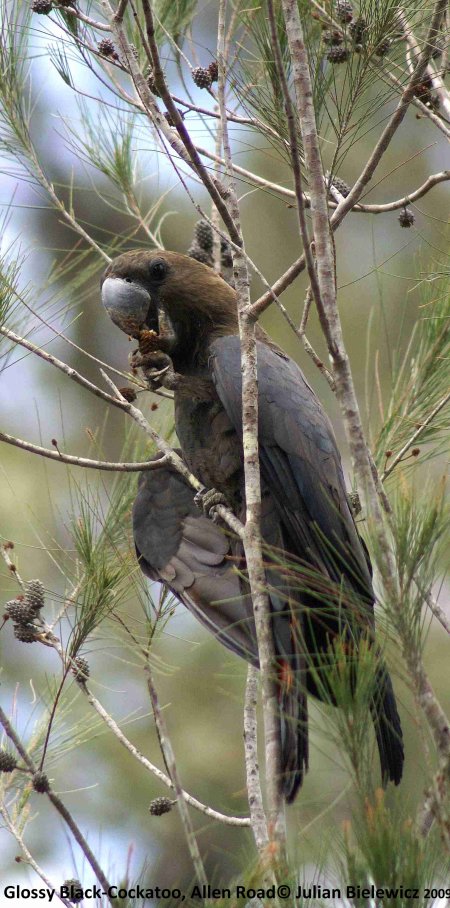
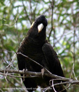 on of the three, is classified as “secure” in all states, in which it is actually present, with the exception of South Australia where it has been defined as “vulknerable.” It is the most common of the Allen Road black-cockatoos.